Notes
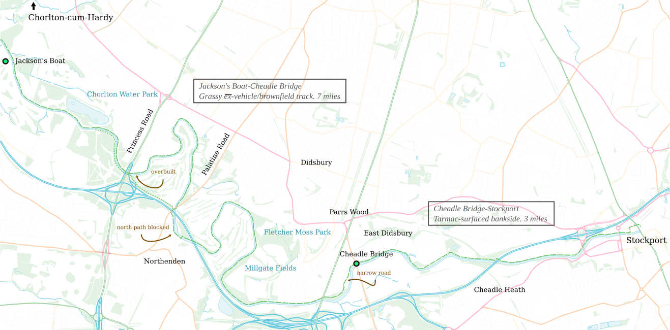
From River Mersey West to end of the Mersey—Stockport. Riverbank walk. Noisy, because weaves the outer ringroad. Near Stockport, popular—on holidays has drinks and food vendors. Can access Chorlton‐cum‐Hardy (try Manchester Road via. Chorltonville, 1 mile), Didsbury Centre (through Fletcher Moss 1/2 mile), the unremarkable but central‐connected Parrs Wood (1/3 mile) and ends at Stockport. Passes Chorlton Water Park (small but good) and Fletcher Moss Park.
Stockport
Stay on bankside until marked road bridge, left to road and ‘Crown’ pub, right under viaduct
Before Cheadle Bridge
Path squeezes past hotel through carpark and narrow road with no pavement
Palatine Road
North path blocked, overbuilt by roadworks. Route well signposted
Princess Street
Alternate path, through outer ringroad junction, cuts a 2/3 mile loop
Jackson’s Boat–Cheadle bridge
Ex‐brownfield, grassy verge. Very wide in places, over 20 feet, but unsurfaced, abandoned to grow. Pleasant for walkers, frequently used by bicycles (beware glass fragments and weaving round foot‐tracks). Unusable for those with stability problems, wheelchairs or prams. River makes wide loops, so unlikely mileage