Notes
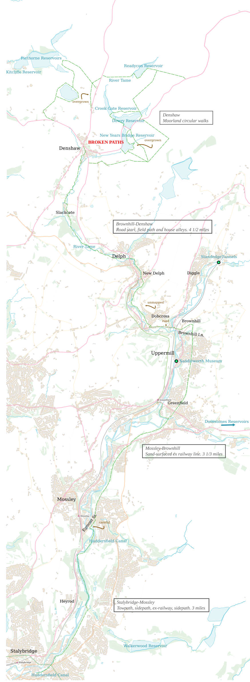
Denshaw
River Tame above Denshaw—Dowry/Readycon reservoirs. WARNING: paths near Denshaw are unmaintained, re‐routed (some not on maps) and/or blocked. High moor so unwalkable without path. Circular walks can be made of paths marked on this and other maps. Start of the Tame is moorland bog near Pennine Way, no reason to visit unless mystic
Delph‐Denshaw
Field‐path. Tricky navigation round houses and through alleys
Uppermill‐New Delph
Valley is narrow, river is crushed with B‐road and factories—avoid. Alternative: East is a field path from ‘Greenfield’ train station that becomes an ex‐railway line, ‘The Donkey Trail’. West is the ex‐railway to Brownhill, then an unavoidable road stretch (river path blocked) to a bridleway (Tame Valley Way cuts between the two)
Mossley, Egmont St
Step onto the riverside, not the canal. Can’t step off the canal